Saturday, 29 December 2012

Arrival in Alice Town, Bimini

Clearing customs, exchanging the Q-flag for the Bahamian flag

Walt caught an albacore tuna crossing the Bahama bank enroute to Chub Cay

Nassau, New Providence.  Atlantis resort in background

Iguanas at Allan's /Leaf Cays, Exumas

Moonrise at Warderick Wells, Dec. 28, 2012

Going ashore at high tide to hike Boo Boo Hill, Warderick Wells, Exuma State park

Oops...low tide left us high & dry

Walt asking the gecko for directions on the trail at Warderick Wells

Sand dollar decoration with "Windspell 2012" painted on it

Boaters add their boat's name to driftwood/natural item and leave it atop Boo Boo Hill, Warderick Wells
It has been 11 days since we left Miami and had a picture-perfect crossing to Bimini Island, Bahamas.  The transition to the "out islands" was very obvious as we raised the Q-flag (quarantine) and cleared into a new country.  The water was clear and turquoise, the pelicans and sharks were fighting for scraps of fish offered  at the fish cleaning station and locals were singing Christmas revival spirituals in the street.
As we crossed the Bahama Bank the next morning in light winds and with a Canadian single-hander following us since Miami, the fishing reel sang a high note and we landed an Albacore tuna.  Our Canadian friend caught 2 inedible barracudas.  We anchored in 15 feet of water that night in the middle of nowhere in calm, but surging seas.  The BBQ tuna that night was tasty!
We entered Chub Cay by early afternoon, took on fuel and went for our first snorkel. A large catamaran from the US hosted the entire anchorage and entertained us with guitar and fiddle music, with some mandolin thrown in as well.
We left early the next morning for Rose Island, but had to divert because of a storm which wasn't supposed to catch up with us until the next day.  As a result, we "experienced" Nassau and Paradise Island's City of Atlantis Resort/Casino.  Our Canadian single-hander friend suffered some damage and was lucky to make it in to Nassau.  He will be making repairs to his 27' boat.  A few days later Windspell had a great sail across to the Exuma's  to Allan's Cay where we really got into the snorkeling and had to share a beach with a group of iguanas-always waiting for the next tourists from Nassau to feed them grapes on a stick.  With us, they had to settle for goldfish crackers-probably a nice change for them!
Now we are slowly making our way down the Exuma islands (cays), stopping on various islands to hike ashore, snorkel the reefs (morning and afternoon slack tides), plan our next sail, read books, paint, and make mental lists of marine wildlife encountered so far.  Currently we are in the first Land and Sea park in the world, established by the Bahamas in 1958.  We have seen spiny lobster, reef and nurse sharks, spotted mantas, sting rays, turtles, large groupers, and a multitude of coloured reef fish with a background of hard and soft corals.  The list goes on....We wish everyone a Happy New Year and all of the best for 2013!

Saturday, 15 December 2012

Exercising at nearby park
Add caption
Visiting Andy's workplace and sampling the wares...

Checking out the dough...
Back onboard Windspell with our new Christmas gift from Heather  & Hayden..a handmade quilt!
We arrived at Coconut Grove on November 27th and took a slip at Dinner Key Marina.  We have enjoyed being able to jump off the boat and go for a daily run and workout in a local park.  Being dockside also made it easy to re-provision for going over to the Bahamas.  We stocked up on dry goods, spare parts, and fuel.. We had a quick visit home December 6-11 to have an early Christmas with Jenn, her partner Eric and his parents-Heather & Hayden, and our son, Andy.  We decorated a tree,  had a great Christmas dinner at Jenn & Eric's, and exchanged gifts.  Eric's mom, Heather, blew Walter & me away with her gift to us...a handmade quilt with sailboats on it.  Each sailboat has our boat's name, "Windspell" on it.  On the Monday we toured Jenn's workplace, Iogen and Andy's workplace, Swiss Pastries.  It was a wonderful opportunity to have a window into their worlds and we are very proud of them!
We returned to our boat and continued to stock it with fresh produce and water.  We are hoping to have a weather window on Monday, December 17 to cross over to Bimini Island, Bahamas...it is supposed to be south winds.  We wait for south winds so they are in the same direction as the Gulf Stream to make the smoothest crossing.  It will take a full day to cross the 43 nautical miles. Once we clear customs, we will have several more day sails to get over the the Exumas -a chain of islands that stretch south.


Saturday, 24 November 2012

The ICW south of Charleston, SC , all the way to north Florida, especially Georgia, had some interesting challenges mostly due to higher tidal ranges  (10 feet) and greater currents due to the larger volume of flowing water. Also, being closer to the Atlantic Ocean with many inlets, full moon tides, and howling north winds for two weeks straight meant that we had to be on our toes all the time. Georgia has very limited resources to keep up with the constant shoaling (our most commonly used word for a week) which often occurs at the ocean inlets creating underwater banks that cut right across dredged waterway channels. The lack of dredging in Georgia provides a great livelihood for companies like Seatow and Towboat US who, for a fee, will pull unlucky and unprepared mariners alike back into the ICW.

We spent many nights anchored in small creeks just off the waterway in what is called the " low country", sheltered from the open Atlantic by a chain of barrier islands. There were very few trees and at night, with the north wind howling through the rigging and Windspell dancing at her anchor due to strong tidal currents, this made for some restless nights with poor sleep. Are you beginning to get the picture? Perhaps the drizzling 50 degree dampness and having no more than 12 inches of water under our keel with less lucky boats aground for us to use as channel markers as we inched by them, helps to paint the picture.

Windspell became a "channel marker" once ( it was our turn) at Dafuskie  Island, Ramshorn Creek, mile 570 of the ICW. A local power boater pulled us off on a rising tide. We would have had to wait six hours if we had gone aground on a falling tide. The good Samaritan told us that the buoy marking the shoal we hit was washed away two weeks earlier by hurricane Sandy.

But all that is passed us now.  The water is clear and turquoise. Windspell has dried out with the warm sunny weather and we saw our first manatee yesterday. The beaches of Fort Lauderdale are wonderful.

Earlier,  Dafuskie Island was mentioned. It got its name because it is " The first Key" encountered along the Eastern seaboard.

The ICW ( we now refer to it as the icyW) has new challenges in Florida, called bridges. We went under at least ten of them yesterday, each of which you have to contact by radio to request an opening. They are like synchronized traffic lights. Heaven help you if you get out of sync. If you do it is a least a 15 to 30 minute wait until the next opening and if there is a 20 knot wind and a 3 knot current pushing you toward the bridge span and you are in line with several other boats that missed the opening it can be dicey, but diplomacy and sound seamanship has prevailed so far.....

We will be in Miami in the next few days which marks the southernmost point before we sail across the Gulf Stream to the Bimini islands of the Bahamas. But first we will visit our kids in Ottawa and restock Windspell.
High tide in St. Augustine..evidence of global warming

Spanish soldier circa 1700, Castello de San Marcos


Add caption

Dental extraction tool in a Spanish colonial surgeon's kit, works like a pipe wrench!


Add caption

Down jacket weather

The top 1% of America's rich

Fort Lauderdale fish sculpture made of disguarded pop bottles

The beaches of Fort Lauderdale

A small cottage on the ICW


Charleston

We sailed into Charleston past Fort Sumter where the first shots of the Civil War were fired.  The next morning we took a tour with a veteran tour guide to get an overview of the city and a rice plantation.  The rice plantations were in their hay-day in the early 1800s to mid-1800s, but after the Civil War when there was so much destruction and slavery was abolished, they were no longer viable.  Many of the land holdings were sold off to the potash industry.  The rice fields of the Magnolia Plantation, which we visited, had reverted back to Cypress swamp.  It is now home to  alligators and migrating waterfowl.  The main house and gardens have been remarkably well preserved, providing a source of tourism today.
We were impressed with the historic city of Charleston.  Their strict rules dealing with the preservation of their historic sites made walking through the streets of Charleston an absolute visual delight.  It was like walking back in time.  The homes had been built by the plantation owners so they had a "town" home in addition to their plantation mansion.  We learned how there are single-room houses (1 room wide) and double room houses (2 rooms wide per floor).  The advantage of the single-room home meant less frontage on the street so there was less tax to pay.  (Some things never change!)  All of the porches faced the ocean to catch the prevailing breeze. The homes and gardens were beautifully restored.  A visit to historic Charleston city was well worth the visit!
Sunbathing ...our first alligator sighting!
Red shouldered hawk looking over the Cypress swamp

Cypress swamp.  Nodules let air into the submerged roots.

Floating duckweed is food for the migrating waterfowl

Ibis birds?

Magnolia Plantation

St. Paul's Cathedral..gothic architecture

Single-room home

Double-room home

Calhoun mansion garden fountain

Hitching post and carriage step


Tuesday, 6 November 2012


Fortunately, we were spared the devastation of Superstorm Sandy  because it veered  northeast and offshore of us in Oriental, NC, then  turned northwest again to lash the coast of New Jersey and New York.  We only experienced 50 mph winds and lots of rain.  There was minimal storm surge.  Windspell suffered no damage.  While waiting out Sandy, we took full advantage of our lovely surroundings.  Donna was in her glory at the fitness centre daily jogging the miles away on the treadmill as the rain slashed down outside.  Walt enjoyed the elliptical followed by the steam shower.  We met lots of other cruisers who shared their experiences along the Intracoastal Waterway (ICW).  We spent the next day undoing all of the preparations we had taken in anticipation of Sandy.  
After being stationary for six days we were glad to continue our southbound voyage which has taken us through Wrightsville Beach, Myrtle Beach, and now we are in Georgetown.  We anchored one evening near Calabash, NC where we had dined 28 years ago when we had done this trip on our previous sailboat.  We had a typical southern dinner of hush puppies with fried shrimp mounded on our plates.  We were delighted to see that nothing had changed in this small fishing town whereas  there has been extensive waterfront development along the ICW with homes and condominiums.  
We are now in the deep south.  We all  know of the vast plantations and the wealth of their owners in this area.  And what did their wealth come from?  Cotton?  No.  Tobacco?  No.  They made their wealth in growing rice and  indigo in this area!  It is unbelievable that they cleared/burned the swamps of cypress trees, drained the swamps, built dykes and planted rice using African slaves.  Of a population of 20,000 people in this area back then, 90 percent were slaves!  Further back from the waterways they grew indigo.  The blue dye was sent to Britain for their naval uniforms.  Many of the plantation owners also had homes in Georgetown.  Strolling the streets of Georgetown you can see the Georgian architecture of their homes, and the streets are lined with Live Oak trees several hundred years old.  
We are now bound for Charleston!


This was the low point during Tropical Storm Sandy...the lowest we have seen our barometer!
Resort River Dunes diningr oom...where we dined during Superstorm Sandy
River Dunes lounge where I beat Walter at Scrabble!
River Dunes pool and fitness centre
Shrimp fleet at Calabash, NC


Cypress swamp along Waccamaw River near Georgetown, SC


diorama showing how the slaves cleared the swamps to  prepare for rice fields
 diorama showing rice fields around Georgetown, South Carolina in early 1800s

Georgetown streets lined with Live Oak trees 

Saturday, 27 October 2012


It's blowing 20 to 38 knots at the moment and we are expecting the brunt of hurricane Sandy by 9 a.m. tomorrow morning. We have Abba on high volume to disguise the howling of the wind and all is good as we have spent the last day preparing Windspell for this "special event". It has been 10 days since we left  Yorktown where we took great advantage of all the historic sites and also did a successful repair of our anchor windlass and had a voluntary US Coast guard inspection which we passed with flying colours. In ten days we have have incredible varieties of experiences and made some  new friends. The photos will explain things well. We hope you don't get too badly effected by Sandy but feel free to join us if you need a safe place to stay....

We will keep you posted.

Donna and Walter

SV Windspell


It's a boat...another repair...a new windlass motor that hauls the anchor up.  It only took Walter 2 days of searching on the internet the entire USA to find one. Thank goodness for the internet;  we didn't have it 28 years ago, but then again, we didn't have an electric windlass.
Norfolk harbour-the largest naval base and busiest seaport in the world.  One of several US aircraft carriers.  To get an appreciation of the size of this ship, check the size of the guy standing on the deck  (LHS) .


Norfolk is mile 0 of the 1100 mile Intracoastal Waterway leading to Miami, Florida.   The first of numerous lift bridges we must pass under.

Entering the lock leading into the Dismal Swamp Canal.  We'll be lifted ten feet.

Dismal Swamp Canal

Sailing across Albermarle Sound to the Alligator River.  Mile 80.

Early morning start...entering the Albermarle-Pungo River canal

Morning mist on the canal

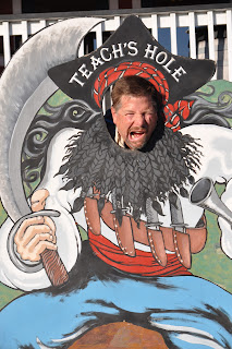
Side trip to Ocracoke Island on Pamlico Sound-the home of  pirate Blackbeard (alias Edward Teach).   

Bike rental to see the ponies of Ocracoke Island.-

DNA samples from the ponies indicate they are descendants of Spanish Mustang ponies- likely  from shipwrecks back in the 1600s.

Voted America's #1 beach for good reason...

We had some awesome body surfing waves 

Overturned horseshoe crab

Pelican in search of his supper

Shorebirds frolicking in the surf

Ocrocoke lighthouse, second oldest original and still functioning in   USA


Gazing inside up the spiral staircase of the lighthouse

We wonder how Hurricane Sandy will measure up...

Windspell stripped and spider strung on a floating dock in a hurricane hole at River Dunes up back creek off the Neuse River in Pamlico Sound    North Carolina